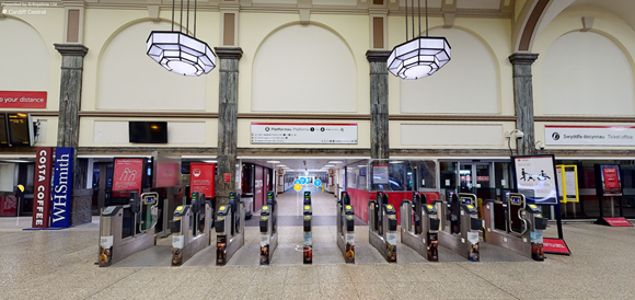
Augmented reality maps of six of Transport for Wales’ biggest stations have been created to help passengers feel more confident when using the rail network.
It is hoped the AR maps can be used to assist passengers visiting a station for the first time or people with mobility issues.
The interactive walk-through maps can be used to locate key areas in the stations including customer information screens, lifts, toilets, help points and waiting rooms.
Created by indoor wayfinding company Briteyellow, the first six maps to be created are of Cardiff Central, Cardiff Queen Street, Newport, Chester, Shrewsbury and Pontypridd and can be viewed here.
Michael Davies, Insights and Innovation Manager at Transport for Wales, said: “These maps will enable customers to plan their journey through the station prior to their visit.
“It’s really a great step towards improving the experience and accessibility needs of our customers, and I’m looking forward to seeing it develop further.